|
THE COLONIAL CHURCH ATLAS
 |
|
|
THE
COLONIAL
CHURCH ATLAS,
ARRANGED IN DIOCESES :
WITH
SOME ADDITIONAL MAPS,
GEOGRAPHICAL AND STATISTICAL TABLES,
AND AN INDEX OF PLACES.
THIRD EDITION.
“THE ABUNDANCE OF THE SEA SHALL BE CONVERTED UNTO
THEE.”
LONDON :
Printed for the Society for the
Promoting Christian Knowledge;
AND SOLD AT THE DEPOSITORY, 77, GREAT QUEEN STREET,
LINCOLN’S INN FIELDS, AND 4, ROYAL EXCHANGE;
BY MESSRS. RIVINGTON, ST. PAUL’S CHURCH-YARD, AND
WATERLOO PLACE;
AND BY ALL BOOKSELLERS.
B. CLAY, PRINTER, BREAD STREET HILL. |
|
|
|
|
|
The Colonial church atlas, arranged in dioceses :
with geographical and statistical tables
was first published in London in 1842, printed for
the Society for the Propagation of the Gospel. It
contains 18 maps of the colonial dioceses as well as
various tables. Preface
by E.H., i.e. Ernest Hawkins, maps drawn and
engraved by J. Archer.
A third edition was published in 1850;
the total number of maps is now 29. The table of
colonial dioceses and some of the maps from this
edition are
reproduced here. |
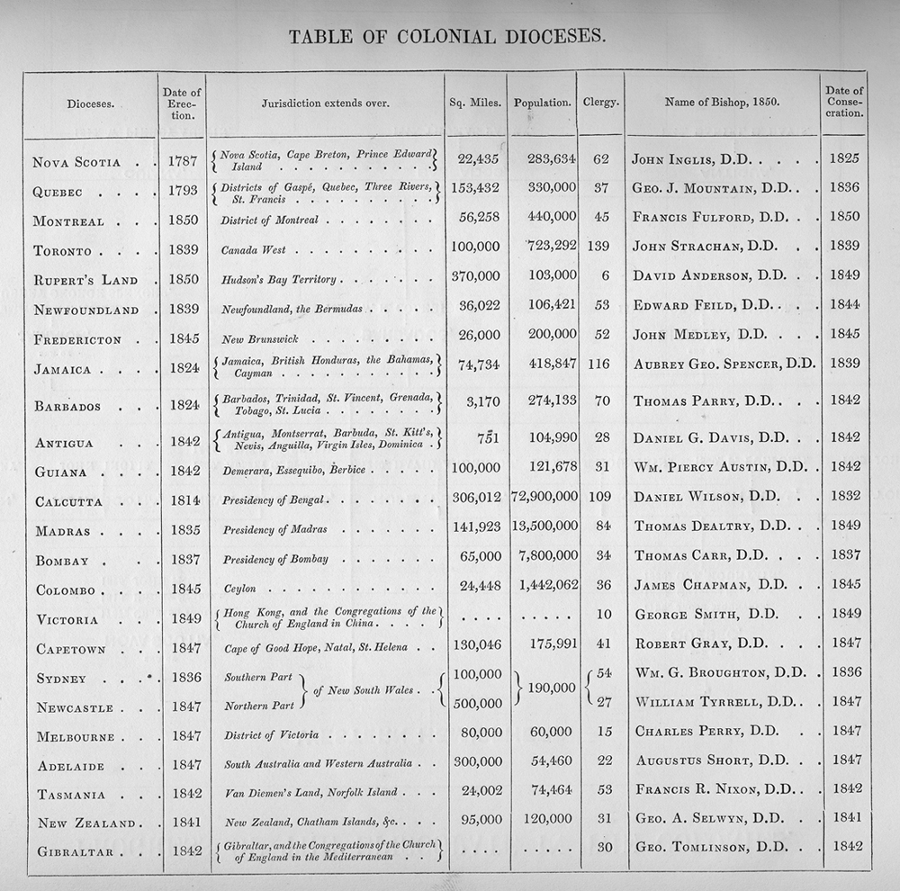
Table of Colonial Dioceses
 Davies Davies
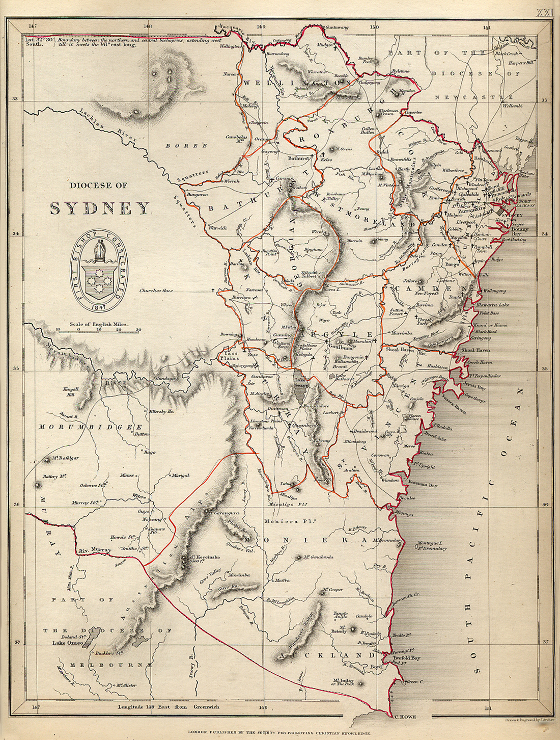
The Diocese of Sydney, Map No. XXI
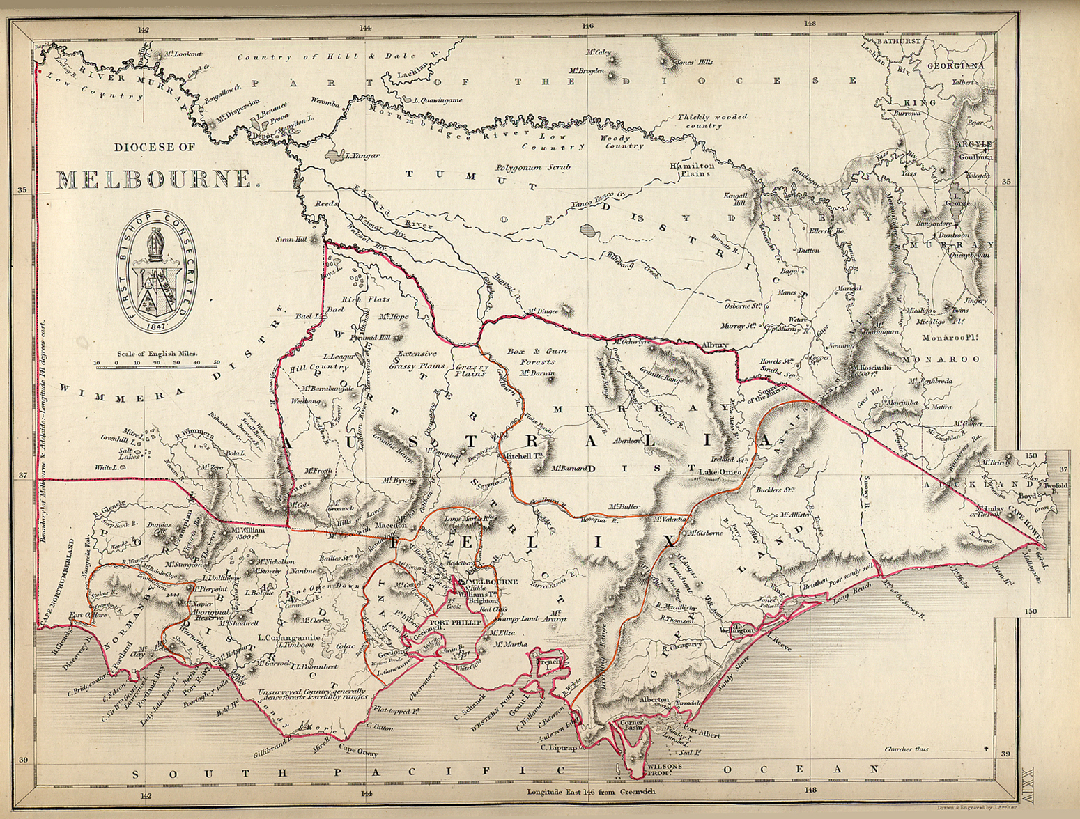
The Diocese of Melbourne, Map No. XXIV
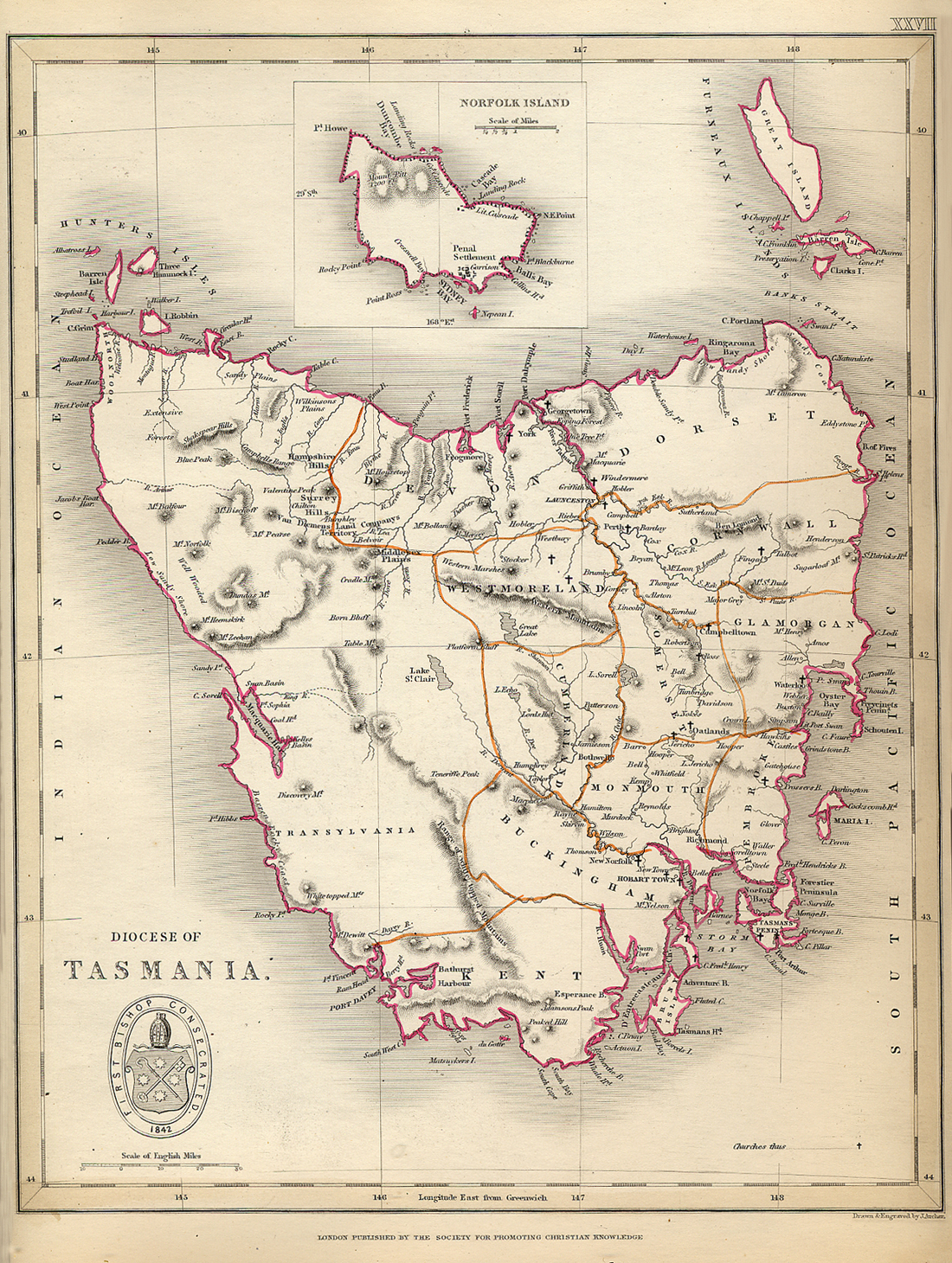
The Diocese of Tasmania, Map No. XXVII
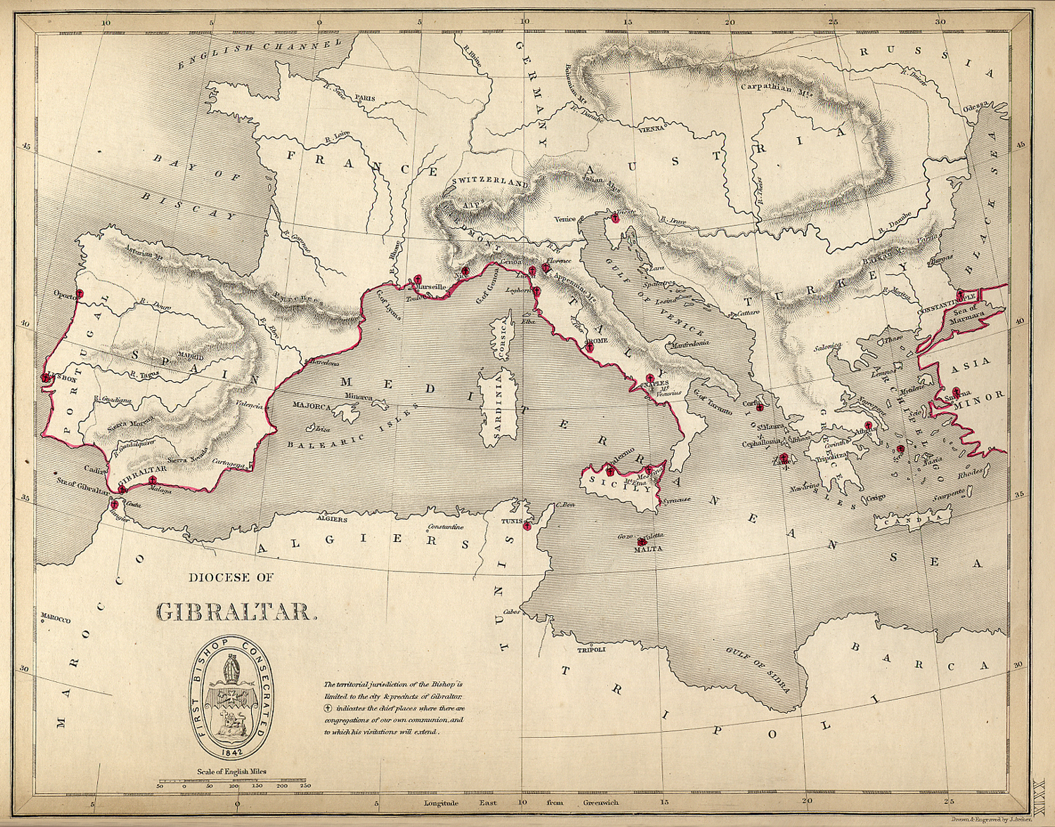
The Diocese of Gibraltar, Map No. XXIX
Venice is not specially marked since this map
was published before Mereweather established the
chaplaincy there, around 1860.
|